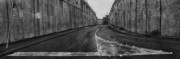
Josef Koudelka About sixty kilometers of the completed Wall consists of eight- to nine-meter-high contrete slabs, particularly in urban areas. Shu'fat Refugee Camp, North-East Jerusalem. Israel-Palestine. 2011. © Josef Koudelka | Magnum Photos
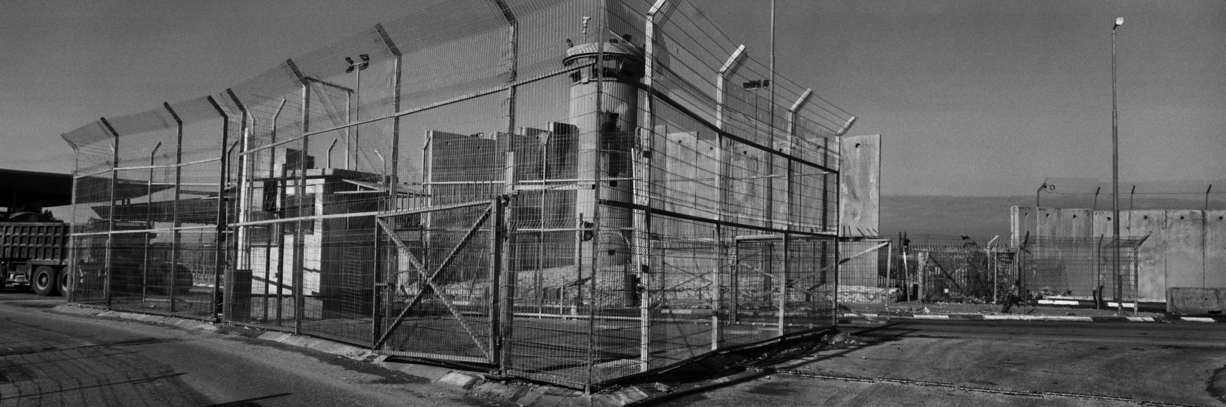
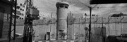
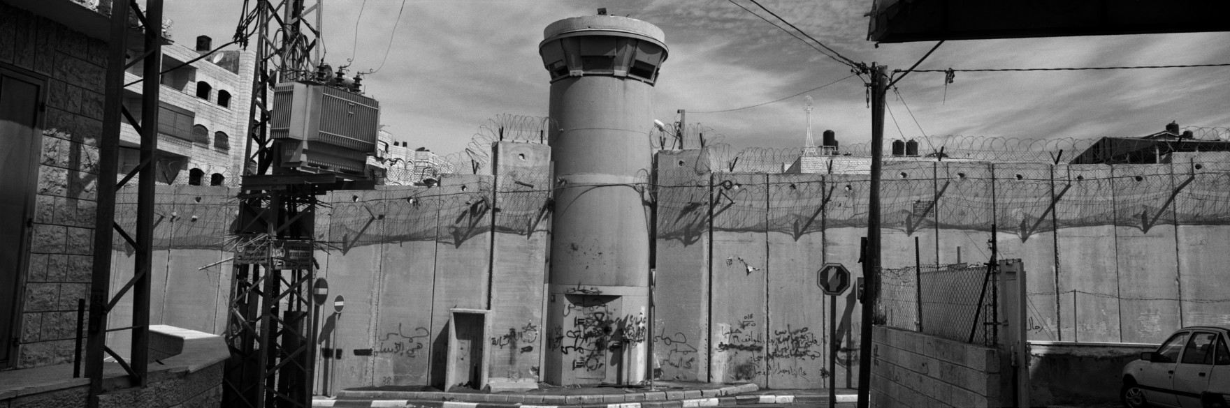
Josef Koudelka Qalandiya checkpoint, Ramallah area. Qalandiya is one of only four checkpoints leading to the Jerusalem area where Palestinians from the West Bank, can enter the city, if granted Israeli-issued per (...)
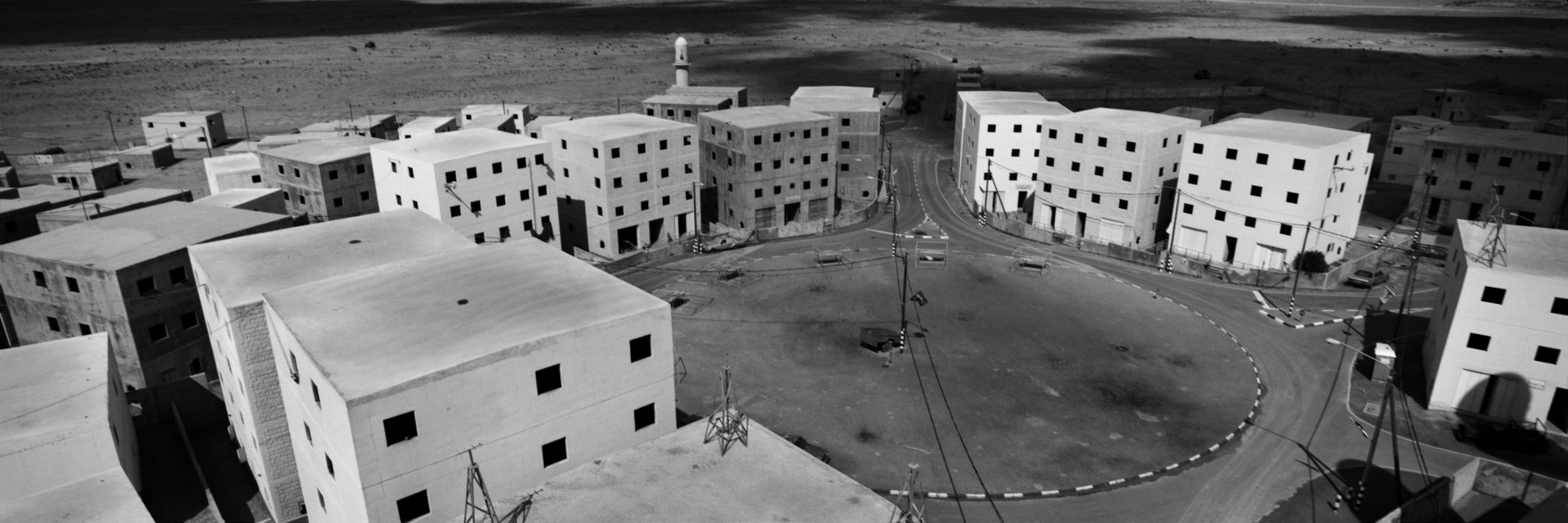
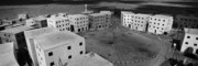
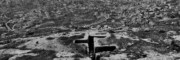
Josef Koudelka 'Detroit' was constructed by the Israeli army to replicate a veriety of Palestinian population centers, in order to practice urban warfare. 'Detroit' (Al Baladiya) training camp, Ze'elim. Israel-Pa (...)
Josef Koudelka Although the Wall is the largest infrastructure project undertaken by Israel, no studies have been carried out to evaluate its environmental impact. Al 'Eizariya (Bethany), East Jerusalem. Israel- (...)
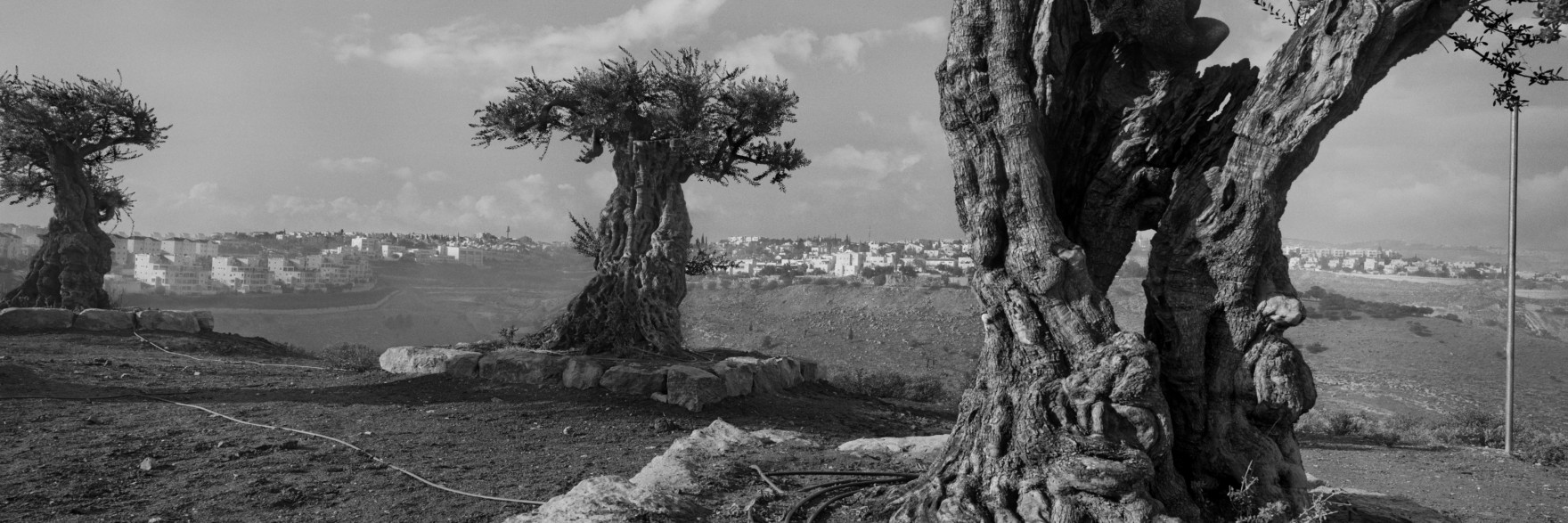
Josef Koudelka ISRAEL- PALESTINE. 2010. Replanted olive trees, Ma'ale Adummim settlement.
Many olive trees in the West Bank were uprooted during construction of the Wall, and many never returned to their Palesti (...)
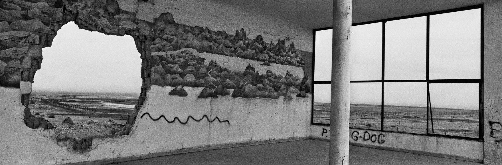
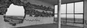
Josef Koudelka Crusader map mural, Kalia Junction, Dead Sea area. Structures from the British Mandate (1922-1948) and Jordanian era (1948-1967) remain in the West Bank. Israel-Palestine. 2009. © Josef Koudelka | Magnum Photos

Josef Koudelka Memorial monument for soldiers of the Israeli Armoured Corps, off Route 91, Golan Heights. Israel's annexation of the Golan Heights in 1981 has not been recognised by the international community, w (...)
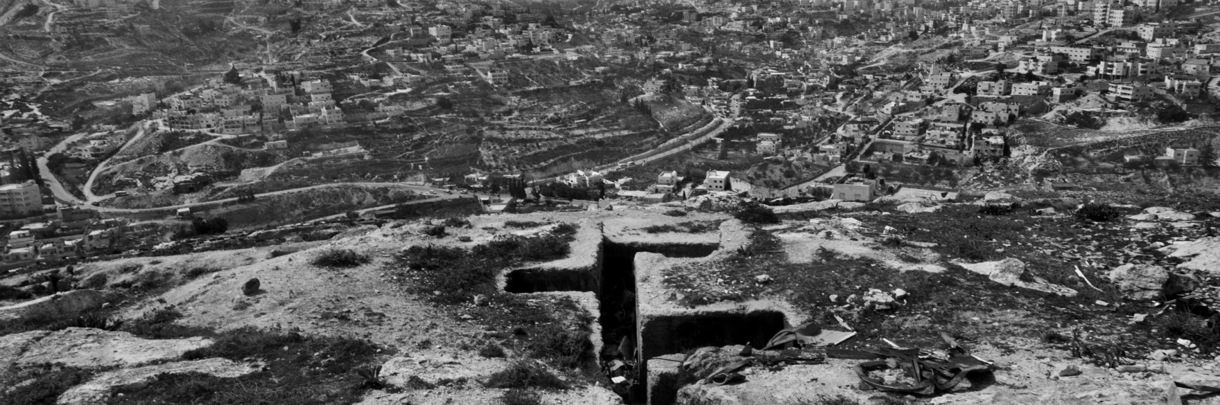
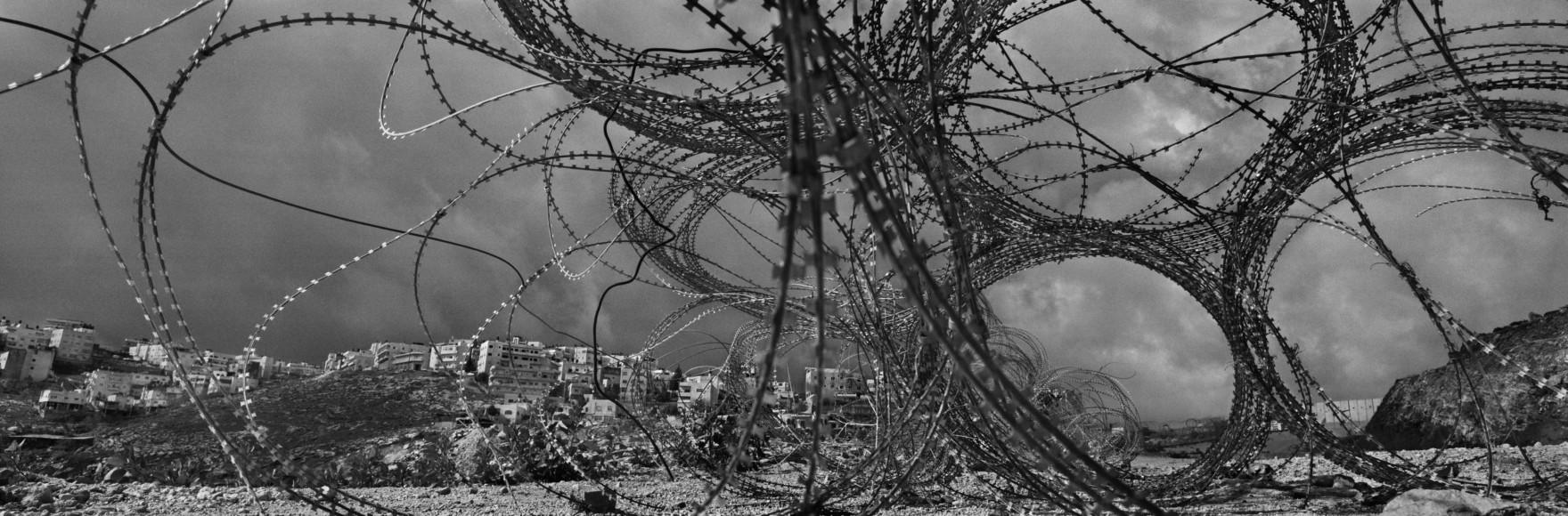
Josef Koudelka East Jerusalem has traditionally served as the focus of political, commercial, religious, and cultural life for the entire Palestinian population of the West Bank and Gaza Strip. Trench, Abu Dis, o (...)
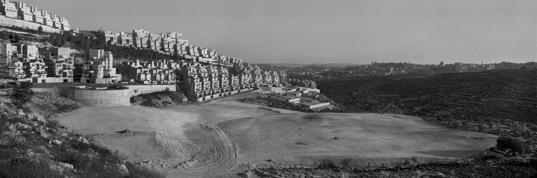
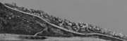
Josef Koudelka ISRAEL- PALESTINE. 2009. Har Homa settlement, overlooking Bethlehem.
Har Homa settlement was established on a forested hill opposite Bethlehem in 1997, despite the previous designation as an envir (...)
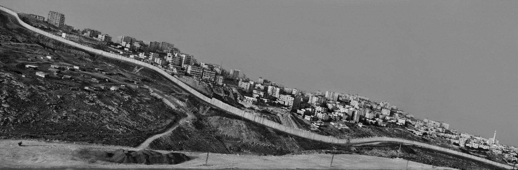
Josef Koudelka ISRAEL- PALESTINE. 2010.. A-Ram, East Jerusalem.
In East Jerusalem, the Wall cuts through Palestinian residential areas. © Josef Koudelka | Magnum Photos
In East Jerusalem, the Wall cuts through Palestinian residential areas. © Josef Koudelka | Magnum Photos

Josef Koudelka The Wall is taking on the characteristics of a unilaterally imposed border, replacing the internationally recognized Green Line. Rachel's Tomb. © Josef Koudelka | Magnum Photos
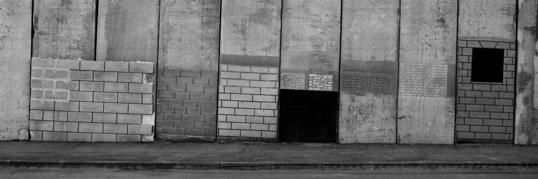
Josef Koudelka In certain areas on the de facto Israeli side of the Wall, especially along motorways, 'aesthetic' panels overlay the concrete slabs. Near Zeitoun checkpoint, East Jerusalem. Israel-Palestine. 2009. © Josef Koudelka | Magnum Photos